RockMass is evolving. Welcome to GroundedAI — the platform powering the future of underground mapping and reporting.

Real-Time Data for Critical Decisions

Datd-collection-banner
Efficient
Data-collection-point
Safe
Data-collection-point
Usable
Data-collection-point
Precise
Data-collection-point
Integrable
Data-collection-point
Accurate

Trusted by leading operations at:

Client-image
Client-image
Client-image
Client-image
Client-image
Client-image
Client-image
Client-image
Client-image
Client-image
Client-image
Client-image
Client-image
Client-image
Client-image

Stories from the Field:

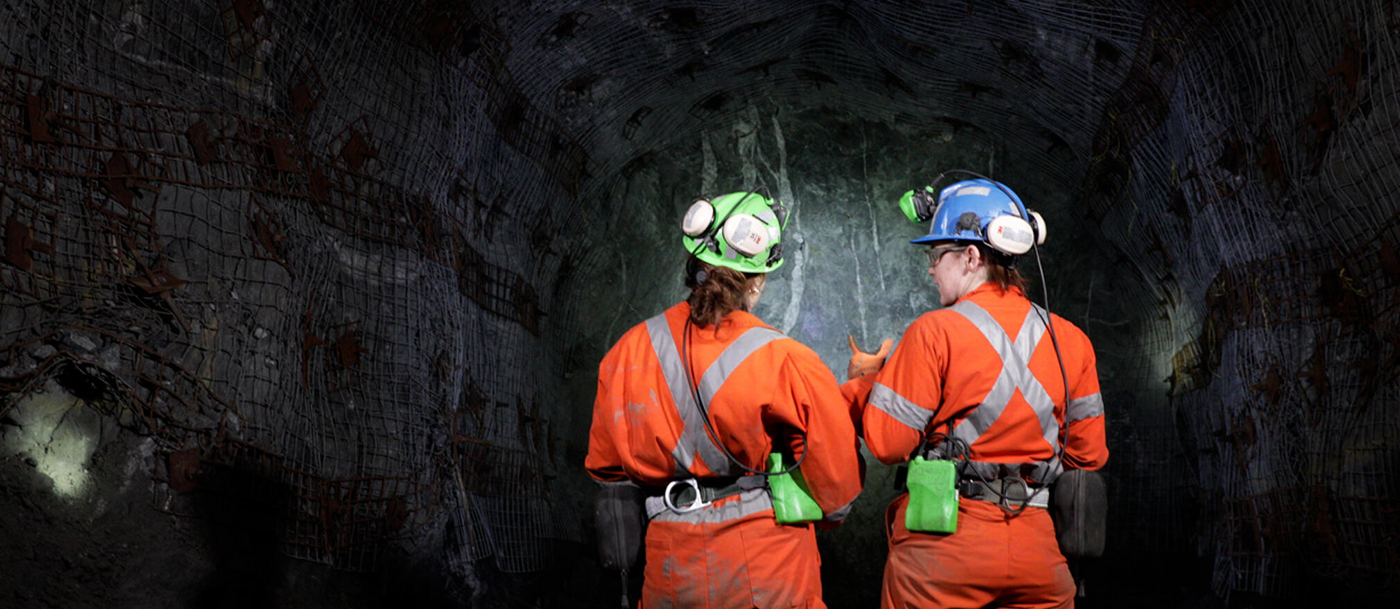
Tunnelling - Geotechnical Mapping

We're able to identify potential hazards and make data-driven decisions that improve safety and efficiency on site

Eliane Cabot

Ex-Senior Rock Mechanics Engineer at Hatch

Watch Now
arrow
Testimonial-image
Testimonial-client-logo

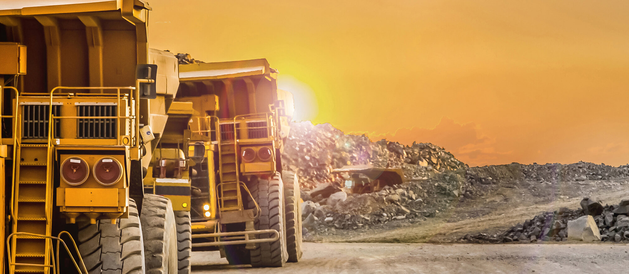
Mining - Geological Mapping

We’ve seen a massive shift in how data is collected. With tools like RockMass Eon, geologists now have access to more accurate,
real-time data without the inefficiencies of manual mapping.

Testimonial-author

Iain McKillip

Manager Mine Technical Services at Glencore, Kidd Operations

Watch Now
arrow
Testimonial-image
Software-icon

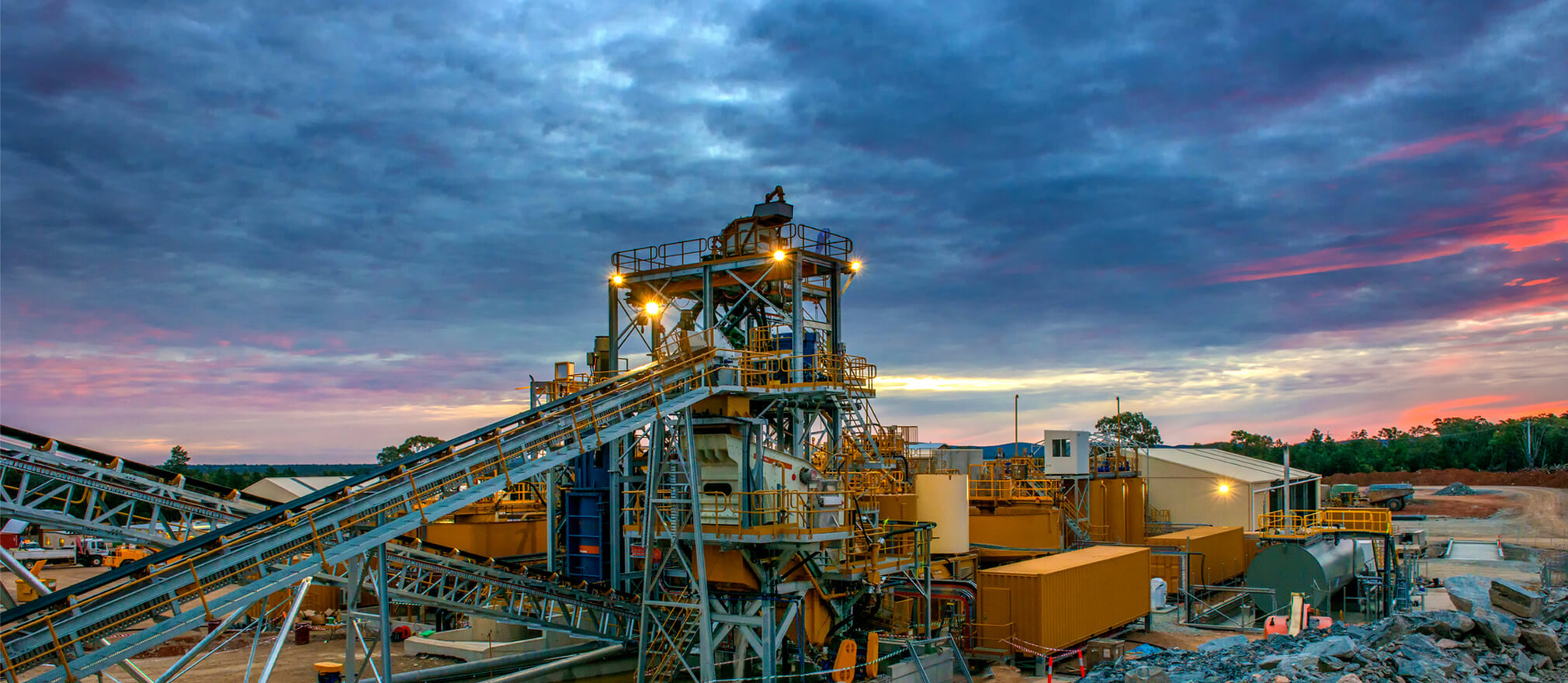
Mining - Accurate data

"Integrating geological data into Leapfrog Geo has never been easier—real-time updates ensure decisions are based on the latest, most accurate data."

Stephanie Vanos

Senior Project Geologist at Seequent

Watch Now
arrow
Testimonial-image

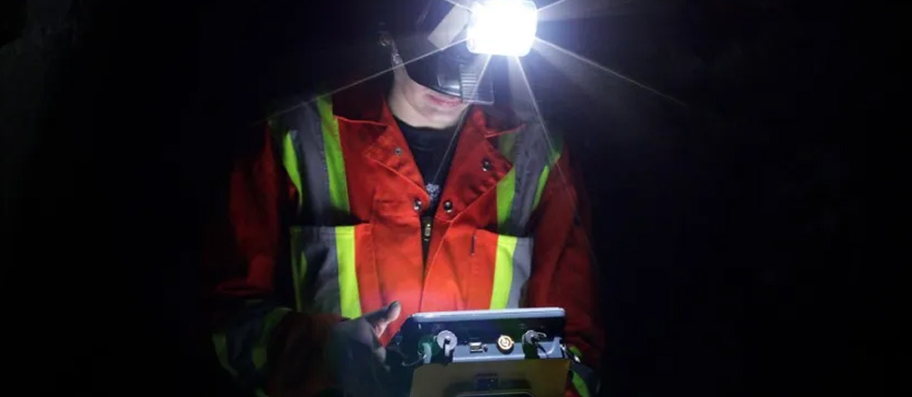
Mining - Digital Trace Mapping

Digital mapping is transforming how we work underground—
capturing more data, more accurately, in less time.”

Samantha Taylor

Senior Geological Engineer at Hatch

Watch Now
arrow
Testimonial-image

RockMass TechTalks: Tunnelling into the Future

As a tunneling professional, I cannot understate the value of working in an iterative feedback loop with tech companies like RockMass to make sure that the solutions they're developing are useful to the practicing engineer, geologist, or field crew.

Gabrielle Mellies

Senior Rock Mechanics Engineer, Stantec

Watch Now
arrow
Testimonial-image

Decision-Making Underground

Mining and tunnelling are no longer data-poor industries. The winners will be those who master the art of translating unruly datasets into actionable intelligence, delivering insights to the right person, at the right time, in the right format.

Shelby Yee

Co-Founder & CEO at GroundedAI

Read More
arrow
arrow
Testimonial-image
Testimonial-image
Testimonial-image
Testimonial-image
arrow
Testimonial-image
Testimonial-image
Testimonial-image
Testimonial-image

How it works

Accurate data, intuitive interface, and robust design

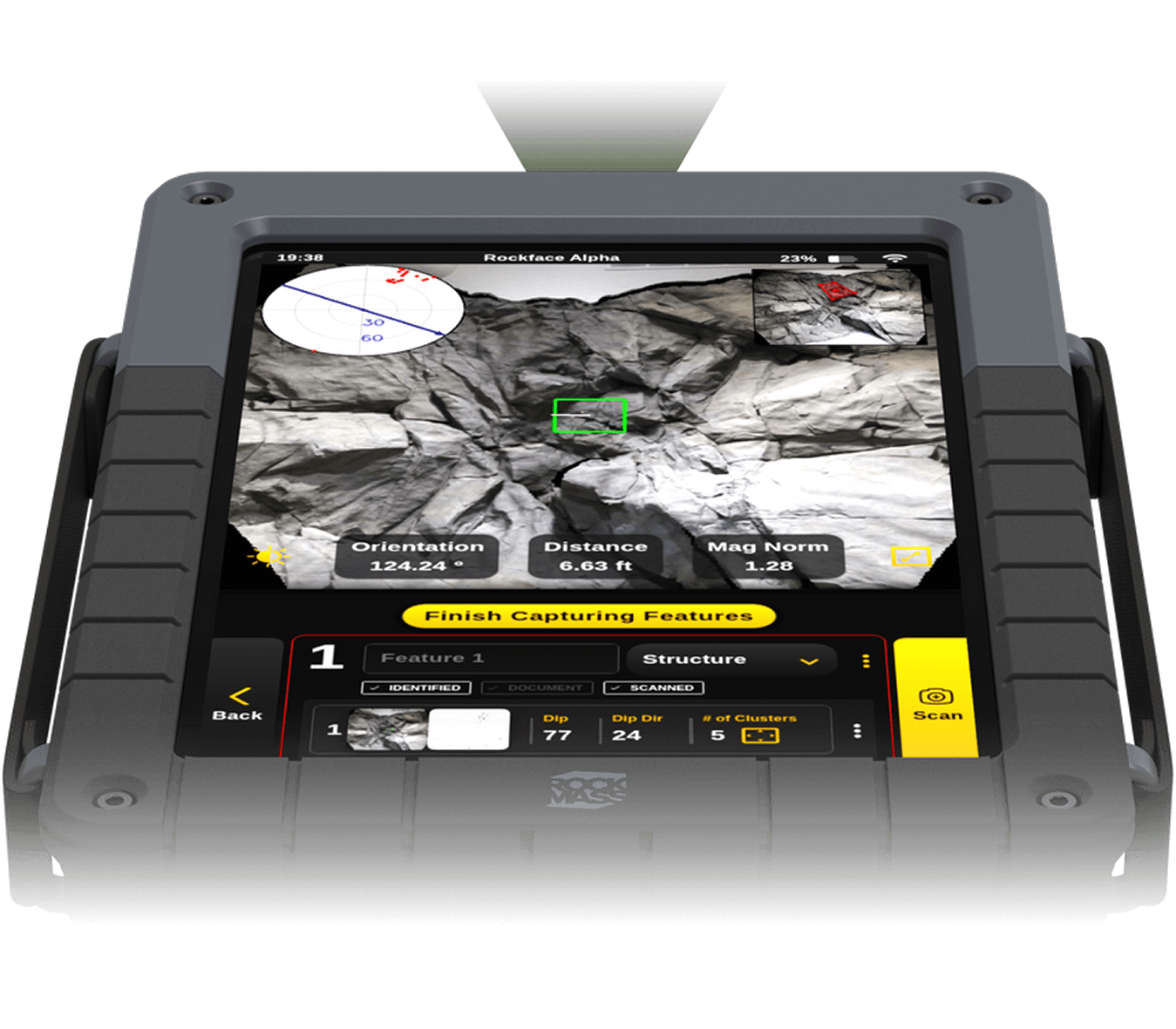
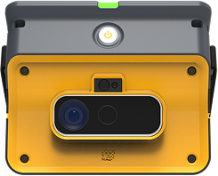
RockMass Eon is a precision geotechnical and geological LiDAR mapping tool engineered to capture accurate, high-quality data for underground mining operations.

How-it-works-image
How-it-works
Precise data collection.

Flexible 3D and 2D Data Capture

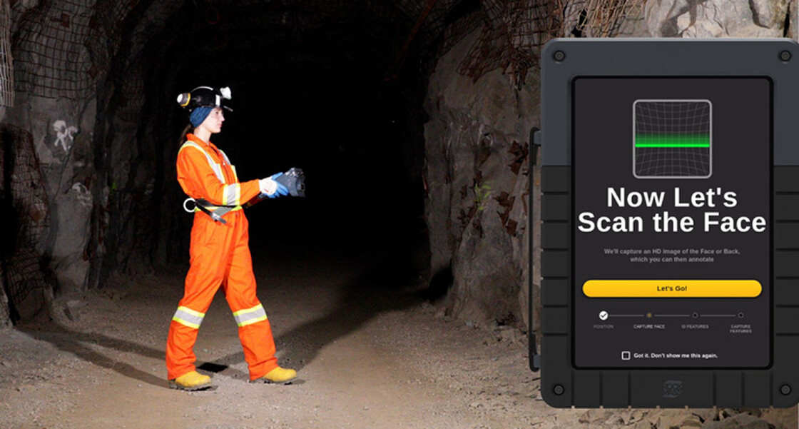
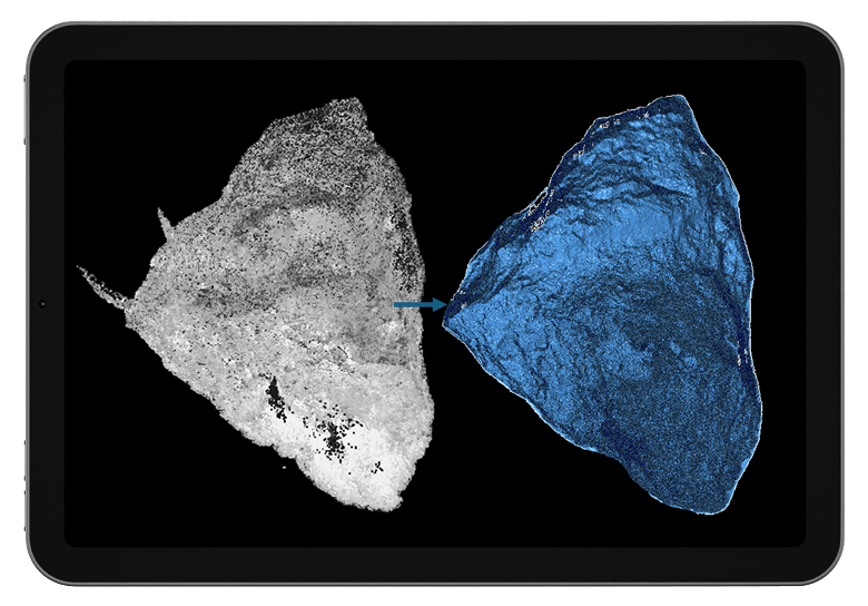
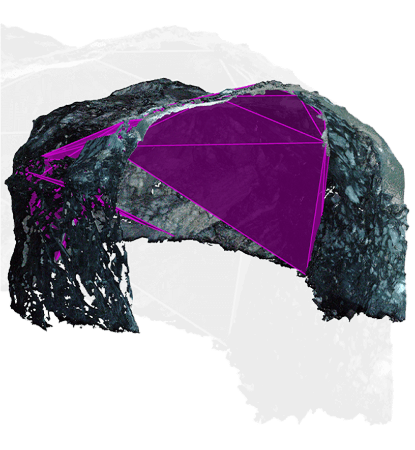
Capture 3D point clouds and 2D HD images simultaneously depending on your needs and standoff distance requirements.

How-it-works
Multi-Area Scanning
How-it-works
HD Images
How-it-works
Coloured point clouds
How-it-works
Manageable file sizes
How-it-works
Fast and accurate geotechnical insights.

Automated Structural Mapping and Stereonet Generation

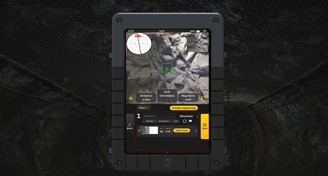
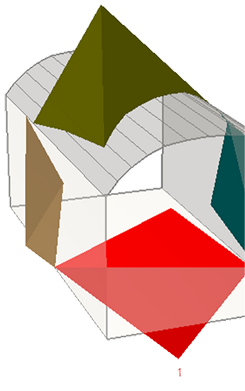
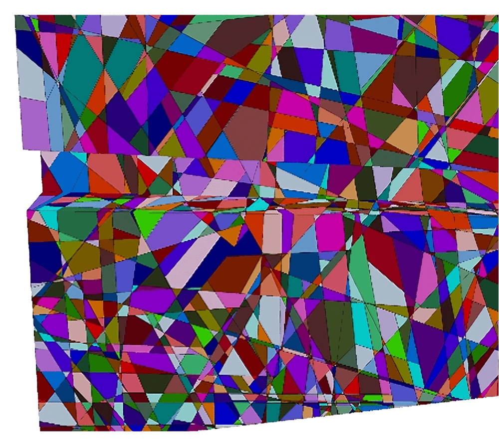
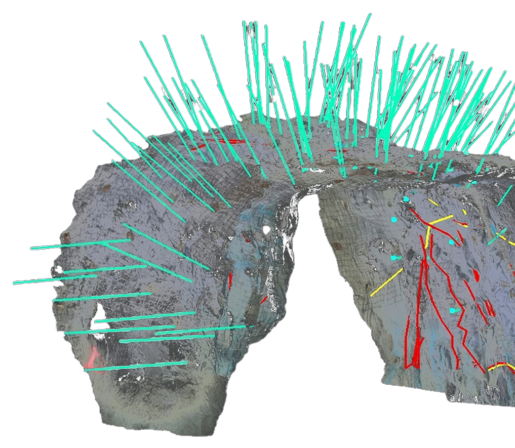
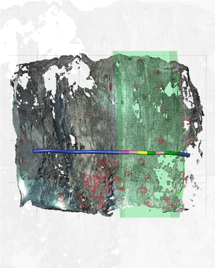
Measure discontinuity orientations from a distance and generate stereonets underground. Digitally record rock mass classifications (Q, RMR, GSI), and automatically calculate a class.

How-it-works
Automated Dip and Dip direction
How-it-works
Real-time stereonet generation
How-it-works
Vectorized annotations
How-it-works
Digital Q, RMR, GSI
How-it-works-image
How-it-works-image
How-it-works
Clear and reliable visual data.

High-Resolution, Georeferenced Outputs

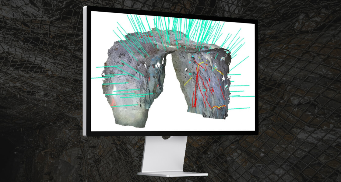
Localization can be done while underground or at surface, resulting in georeferenced outputs.

How-it-works
Sample data
How-it-works
True colour point clouds
How-it-works
Feature annotations
How-it-works
Rock mass classifications
map-image
How-it-works
Tailored mapping to fit your site’s needs.

Versatile Mapping Options

Flexible data-sharing and mapping solution that is customizable for individual users or departments.

How-it-works
Customizable attributes
How-it-works
Discipline-specific features
How-it-works
Local calibration
How-it-works
Site-specific data forms
How-it-works
Precision and control in mapping.

Detailed Feature Capture

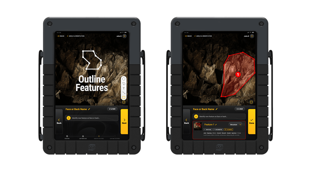
Draw annotations and customize feature attributes underground.

How-it-works
Annotation tools
How-it-works
Feature customization
How-it-works
Interactive touch-screen
How-it-works
Geological and Geotechnical Mapping
map-image
map-image
How-it-works
Standardized and reliable data.

Consistent Data Collection

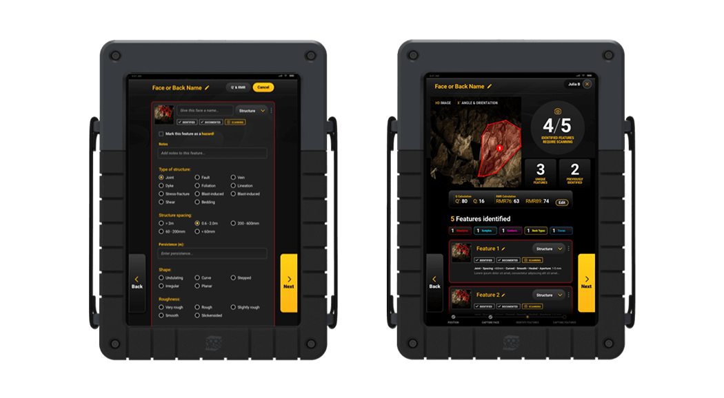
Systematic naming conventions and file formatting ensure uniformity.

How-it-works
Site-wide consistency
How-it-works
Generic output file formats
How-it-works
Standardized workflows
How-it-works
Standardized naming
conventions
export-image
How-it-works
Efficient data integration.

Centralized Data Access

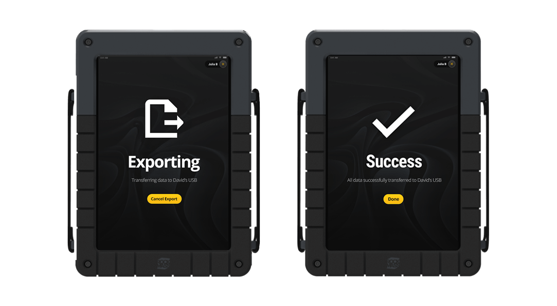
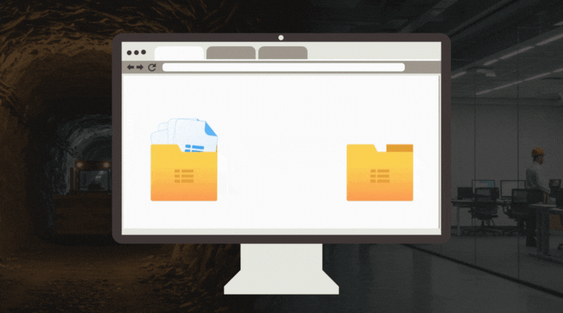
Sync your data or import the files locally into CAD, geological, and
geotechnical software you're already using.

How-it-works
Sync with CAD & Industry Software
How-it-works
Simplify your workflow
How-it-works
Safer and more reliable data management.

Digital Safety and Efficiency

Digital mapping reduces time at the face and prevents loss of data.

How-it-works
Digital-first mapping
How-it-works
Time-saving workflows
How-it-works
Data loss prevention
How-it-works
Enhanced data fidelity
export-image
export-image
How-it-works
Flexible and manageable file handling.

Manageable File Sizes

File sizes from 35–50 MB allow for easy uploading, sharing, and storage.

How-it-works
File formatting
How-it-works
Site-wide consistency
How-it-works
Standardized workflows
How-it-works
Standardized naming conventions

Why RockMass Eon

Empower your team with underground data you can be confident in

RockMass Eon simplifies underground mapping, enhances safety, and enables precise decision-making for greater operational efficiency.

25

Mapping per face

+

75

Features mapped per scan

+

25

Sites powered by RockMass

Solutions and capabilities

Capture Meaningful Data for your Underground operations

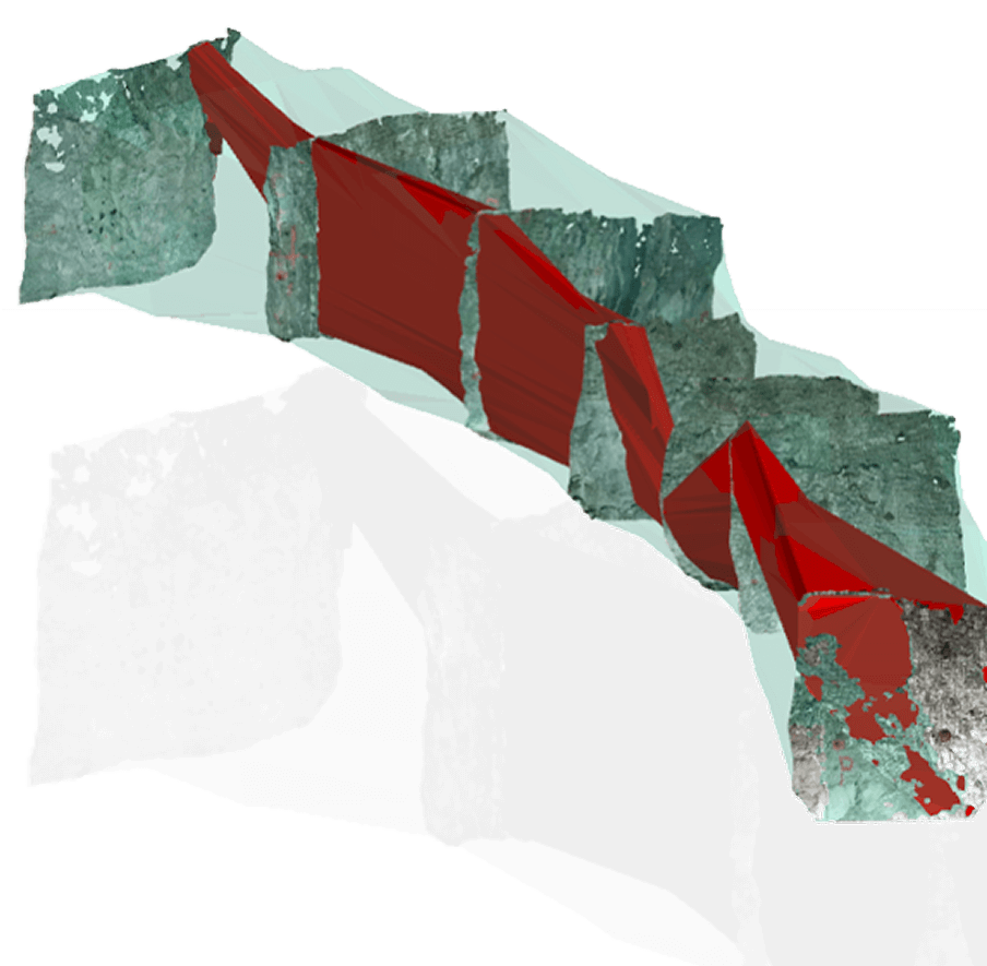
RockMass Eon geo references data underground, eliminating gaps and providing the clarity needed for critical decisions.

Geological Mapping
Geotechnical Mapping
dips-focus-imagegeotechnical-imggeotechnical-imggeotechnical-imggeotechnical-imggeotechnical-img
Capabilities-card

Ergonomic Design

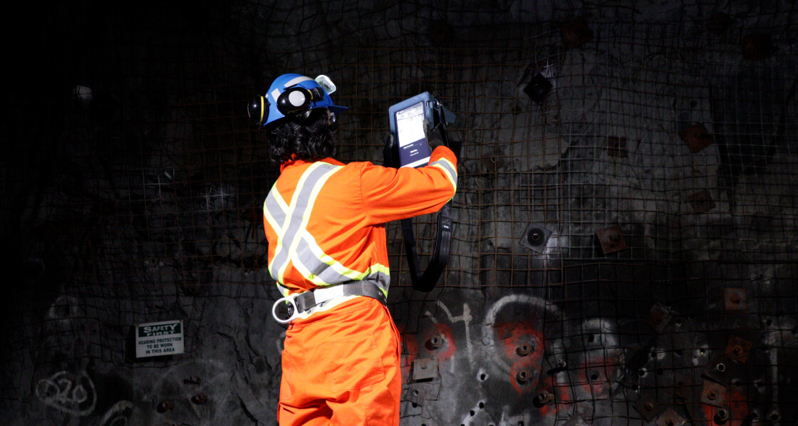
Ergonomic, handheld design for underground mapping with precision and ease.

Capabilities-card

Georeferenced Data On-the-Go

Capture high-fidelity, georeferenced data on the go or with tripod-mounted stability.

Capabilities-card

Real-Time Accuracy

Achieve reliable, high-precision measurements in real time.

Capabilities-card

Structural Mapping for Risk

Improve risk assessment through precise structural mapping and fault detection.

Capabilities-card

Confident Decision-Making

Enhance data accuracy for more confident decision-making in high-stakes environments.

Capabilities-card

Ground Support Validation

Simplify ground support validation by accurately recording all ground support elements.

Capabilities-card

Accurate Mine Planning

Reduce data uncertainty, enabling more accurate mine planning and design.

Capabilities-card

Geotechnical Insights Simplified

Make informed operational decisions with precise geo-technical data collection and analysis.

Capabilities-card

Software Ready export

Export easily to leading post-processing software (e.g., Leapfrog, Deswik, Itasca...)

Explore the RockMass Eon

Map to Industry-leading Software such as:

Software-icon

Leapfrog

Seamlessly update your models with structured RockMass data.

Import georeferenced, attributed meshes and polylines directly into Leapfrog for up-to-date geological models.

Software-icon

Deswik Spatial

Streamline mine design with structured geological data.

RockMass delivers ready-to-use datasets for stope design, ground support planning, and ore delineation in Deswik.

Software-icon

Rocsience Dips and Unwedge

Instantly visualize structural data for geotechnical analysis.

RockMass provides ready-to-use stereographic plots and kinematic inputs in Dips & Unwedge—no manual adjustments needed.

Software-icon

ITASCA FLAC3D & 3DEC

Enhance geomechanical modeling with structured data.

Import georeferenced structural datasets for stress modeling, ground stability, and excavation analysis.

Give your team the data they need

Transform Your Mapping Process with RockMass Eon

Data-collection-focus

RockMass

Eon

footer-cta-card-1

GroundedAI

Make the underground visible

Newsletter

Stay ahead with our monthly bulletin—get case studies, product updates, and event news.

Thank you! Your submission has been received!
Oops! Something went wrong while submitting the form.
footer-cta-card-3