Map to every Industry-Leading Software:
RockMass enables a seamless workflow compatible with Deswik to streamline dataflow and improve decision-making
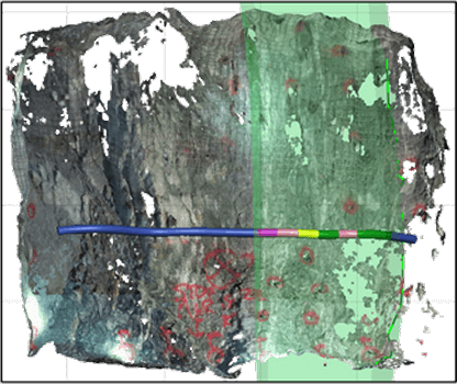
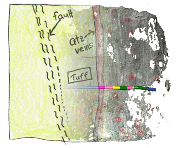
Digital Ground Support Mapping

Use Cases:
Digitally map underground geological complexity with high-precision data, ensuring better mine planning, automated analysis, and seamless integration with Deswik
Ground Control
Reduce dilution and improve ore recovery with high-resolution point clouds for accurate ore/waste delineation and reconciliation of planned vs. actual extraction
Proactive Mine Design
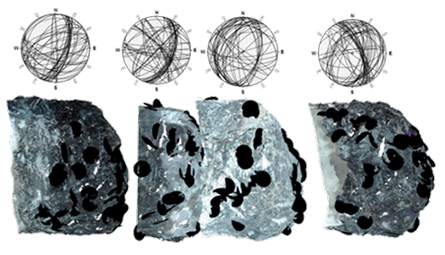
Refine stope geometry, drift alignments, and infrastructure placement using discontinuity data from point clouds, ensuring safer and more efficient designs
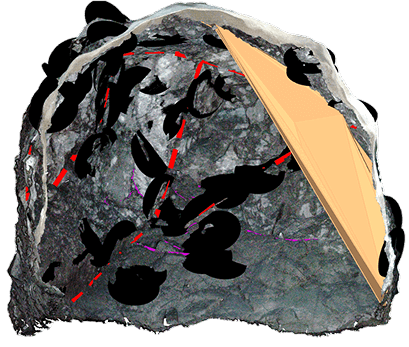
Ground Support Auditing

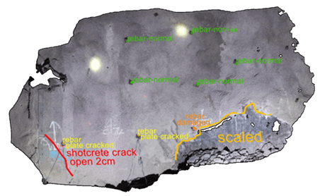
Digitally assess bolt placement, screen coverage, and shotcrete thickness to enhance safety compliance and operational efficiency
RockMass solutions support various file formats to ensure compatibility with Deswik, eliminating inefficiencies while enabling precise and actionable mine planning workflows.
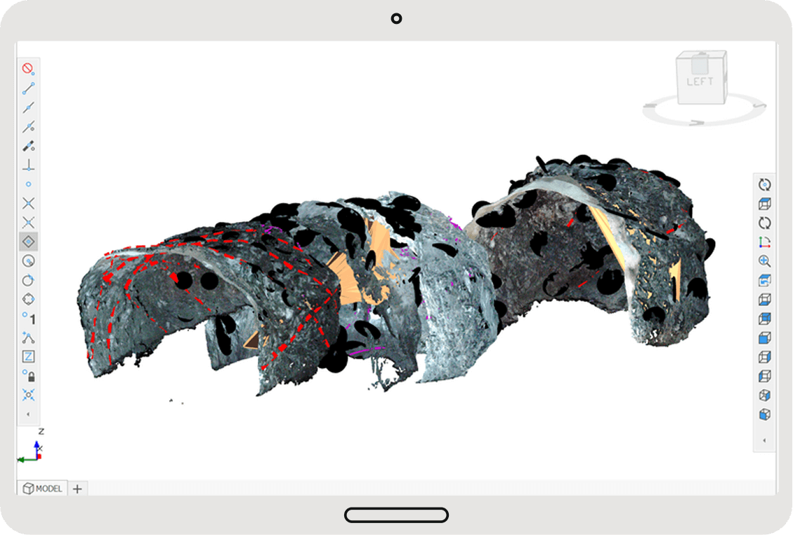
Ground Support Auditing with Deswik
Supported Data Formats:
Solutions
From data capture to decision-making, RockMass ensures your 3D point cloud data is structured, georeferenced, and seamlessly integrated into Deswik for maximum operational impact
Capture accurate, high-quality data for geological modeling with a LiDAR-based mapping tool.
Turn Data into Action
We do the mapping, extraction, and formatting—so you don’t have to
Make the most of your data
End-to-end support to help you make confident decisions with your data into Deswik—ensuring accuracy, efficiency, and minimal effort on your end.
Leapfrog
Seamlessly update your models with structured RockMass data.
Import georeferenced, attributed meshes and polylines directly into Leapfrog for up-to-date geological models.
Deswik Spatial
Streamline mine design with structured geological data.
RockMass delivers ready-to-use datasets for stope design, ground support planning, and ore delineation in Deswik.
Rocsience Dips and Unwedge
Instantly visualize structural data for geotechnical analysis.
RockMass provides ready-to-use stereographic plots and kinematic inputs in Dips & Unwedge—no manual adjustments needed.
ITASCA FLAC3D & 3DEC
Enhance geomechanical modeling with structured data.
Import georeferenced structural datasets for stress modeling, ground stability, and excavation analysis.
RockMass enables seamless data integration into Deswik—ensuring accuracy, efficiency, and smarter decision-making at every stage.

Make the underground visible
Stay ahead with our monthly bulletin—get case studies, product updates, and event news.