RockMass is evolving. Welcome to GroundedAI — the platform powering the future of underground mapping and reporting.

brand-logo
repeat-icon
Software-icon

Deliver Structured Data into Leapfrog Without the Bottlenecks

RockMass transforms raw scans into clean, georeferenced datasets, improving geological interpretation with mapped, structured data.

Map to every Industry-Leading Software:

Software-icon
Software-icon
Software-icon
software-icon
Software-icon
Software-icon
Software-icon
Software-icon
software-icon
Software-icon
Software-icon
Software-icon
Software-icon
software-icon
Software-icon

Maximize the potential of digitally collected data in Leapfrog Geo

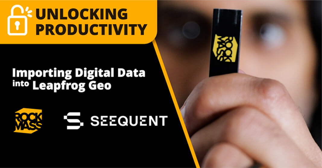
Explore how RockMass simplifies mapping workflows to Leapfrog Geo, delivering reliable, georeferenced datasets for actionable insights.

case-study-img

Revolutionize your geological workflow

On-demand Webinar

In this on-demand webinar, you'll gain valuable insights on:

list point
Importance of precise geological mapping
list point
Essential day-to-day data for underground mining
list point
The transition from pen-to-paper to a digital-first revolution
list point
Streamlined workflow for superior decision-making

Use Cases:

Unlock the Power of Point Cloud Data in Leapfrog Geo

We enable mines to leverage available point cloud data to help draw actionable insights from them
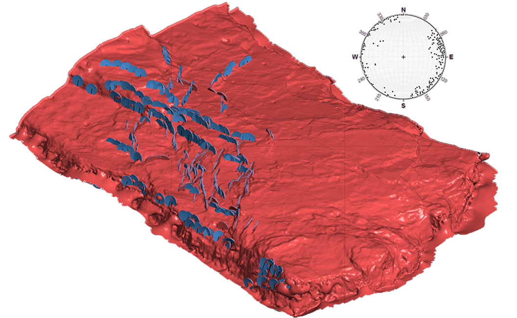
Structural Mapping

use-case-card-icon
rock-image

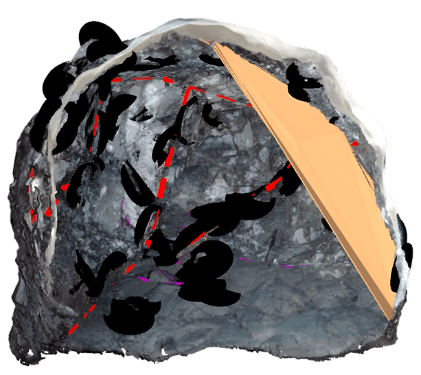
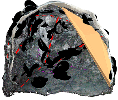
Extract high-resolution structural data, like dip and dip-direction, from point cloud files for geotechnical modeling and
domaining.

Resource Definition and Vein Modelling

use-case-card-icon
deswik-focus-image

Precisely map veins and enhance resource models with high-resolution point cloud data

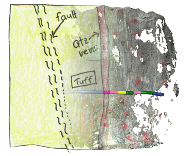
3D Lithological and Alteration Modeling

Planning-card
use-case-image

Quickly evaluate volumetric differences
between planned and actual stope breaks using processed point cloud data.

3 of 4 mines capture Point Cloud Data, but much of it is inaccessible or unusable in current mine planning, costing mines millions in profit”

3 of 4 mines capture Point Cloud Data, but much of it is inaccessible or unusable in current mine planning, costing mines millions in profit”

3 of 4 mines capture Point Cloud Data, but much of it is inaccessible or unusable in current mine planning, costing mines millions in profit”

arrow
arrow

Update Your Grade-Control Model With Real-time 3D Mapping

Ensure compatibility with Leapfrog Geo and eliminate inefficiencies in data handling while ensuring precision for geological and geotechnical workflows.

integration-data-img

Stope Design Optimization with Leapfrog Geo

data-integration-icon
Import 3D Data Quickly
data-integration-icon
Effortless Precision
data-integration-icon
Data-Driven Decisions

Supported Data Formats:

Manipulate and down sample point clouds
Seamless compatibility with Seequent Leapfrog
Georeference point clouds  
Manages Large-Scale Datasets
Multi-file processing
Smart version control

Solutions

How We Work with You

Whether you need reliable 3D data capture solutions or want to transform your point cloud data
into actionable insights for better interpretation and decision-making

Precision You Can Trust Underground

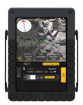
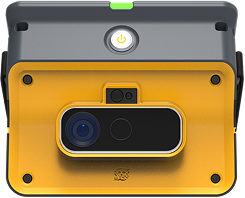
Capture accurate, high-quality data for geological modeling with a LiDAR-based mapping tool.

solution-icon
Ground Support As-Built Records
solution-icon
Structural Mapping and Measurements
solution-icon
Geomechanical Modeling
solution-image

Turn Data into Action

Simplify Your Mine Planning Workflows

We do the mapping, extraction, and formatting—so you don’t have to

solution-icon
Standardized & Georeferenced Datasets
solution-icon
Segment and downsample data
solution-icon
Map critical information
solution-image

Make the most of your data

Our Process, Built for Your Operations

End-to-end support to help you make confident decisions with your data into Deswik—ensuring accuracy, efficiency, and minimal effort on your end.

solution-icon
Expert Training and Guidance
solution-icon
Streamlined Implementation
solution-icon
Optimized Data Integration
solution-image

Map to Industry-leading Software such as:

Software-icon

Leapfrog

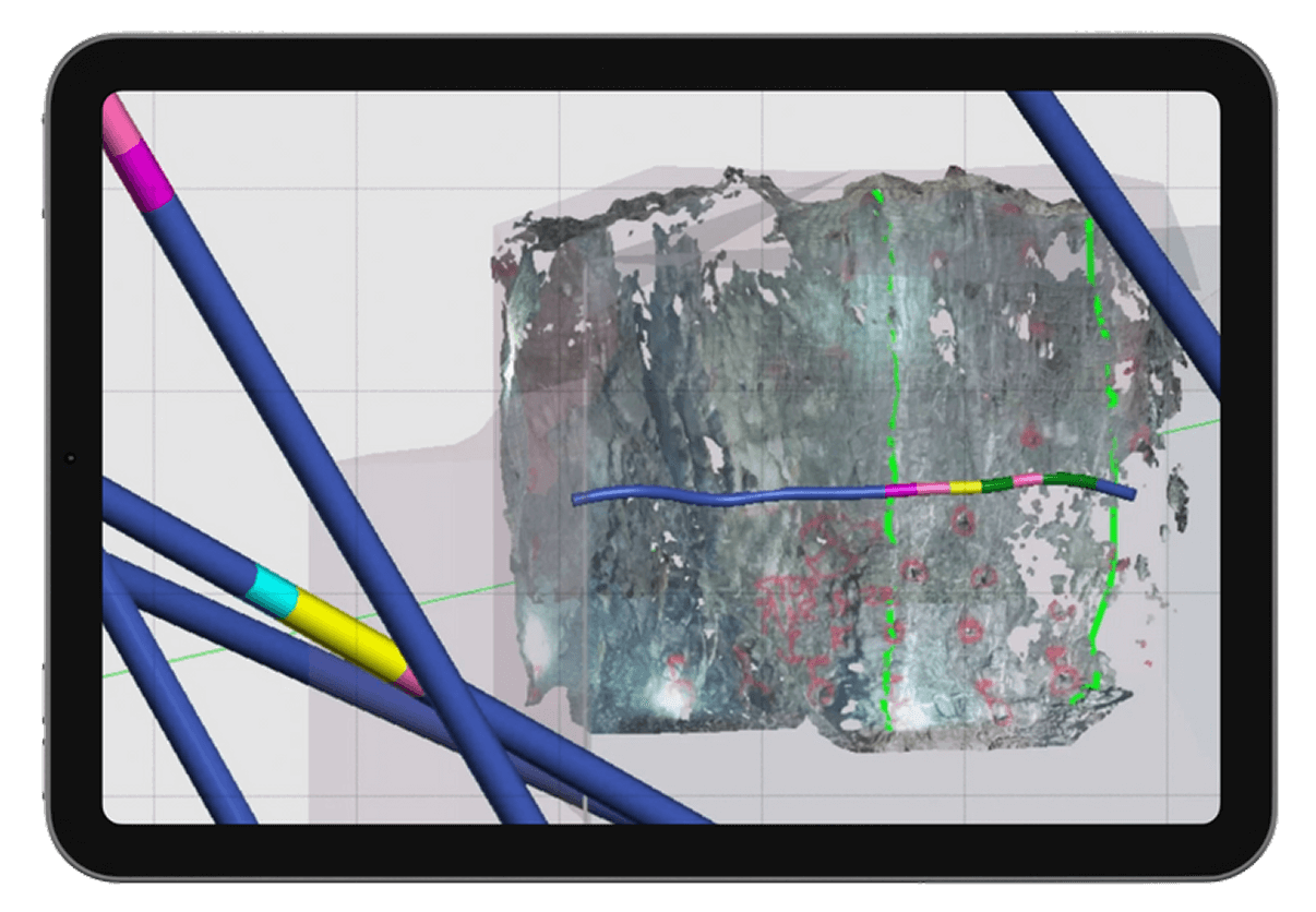
Seamlessly update your models with structured RockMass data.

Import georeferenced, attributed meshes and polylines directly into Leapfrog for up-to-date geological models.

Software-icon

Deswik Spatial

Streamline mine design with structured geological data.

RockMass delivers ready-to-use datasets for stope design, ground support planning, and ore delineation in Deswik.

Software-icon

Rocsience Dips and Unwedge

Instantly visualize structural data for geotechnical analysis.

RockMass provides ready-to-use stereographic plots and kinematic inputs in Dips & Unwedge—no manual adjustments needed.

Software-icon

ITASCA FLAC3D & 3DEC

Enhance geomechanical modeling with structured data.

Import georeferenced structural datasets for stress modeling, ground stability, and excavation analysis.

Transform Geological Data into Actionable 3D Models

Import clean, structured datasets into Leapfrog Geo to accelerate geological interpretation, support resource estimation, and eliminate manual prep work.

data-service-focus

RockMass

Eon

footer-cta-card-1

GroundedAI

Make the underground visible

Newsletter

Stay ahead with our monthly bulletin—get case studies, product updates, and event news.

Thank you! Your submission has been received!
Oops! Something went wrong while submitting the form.
footer-cta-card-3