RockMass is evolving. Welcome to GroundedAI — the platform powering the future of underground mapping and reporting.

Focus on Decisions, Not Data Processing

Get more out of your point clouds

It is not about importing point clouds. We process, extract, and refine critical structural data.

point-clouds-banner

Simple Step-by-Step process

01

We get to know your data needs

We assess your mapping requirements compatibility with our “mapping workflows

02

You start transferring data

We make it easy to share your point cloud datasets

03

We map for you

We process your point cloud data to extract highly accurate geological and/or geotechnical features

04

Use your Mapped Data

We deliver ready-to-use mapped datasets in formats compatible with your software

Simple Step-by-Step process

 Turn raw geological data into structured, decision-ready insights

Why Point Cloud Mapping Service

Minimize Risks, Maximize Results

Discover how our point cloud mapping service helps you avoid common challenges in data processing, integration, and geological analysis, ensuring accuracy, efficiency, and actionable insights every time.

capabilities-icon

Manual Mapping Errors

We streamline geological and geotechnical mapping, minimizing human error and ensuring consistent, reliable results.

capabilities-icon

Time-Consuming Data Integration

Our ready-to-use datasets integrate seamlessly with your software, halving integration time.

capabilities-icon

Lack of Expertise

We simplify point cloud processing, letting your team focus on decisions without needing technical expertise.

capabilities-icon

Overwhelming Data Volumes

Our workflows distill massive datasets into actionable insights, avoiding data overload.

capabilities-icon

Missing Key Geological Features

We combine expert mapping with precise 3D analysis to accurately identify critical features like veins and faults.

capabilities-icon

Delays in Quarterly Reporting

Quick turnarounds and efficient protocols ensure mapping is ready before deadlines.

Transform Geological Data into Actionable 3D Models

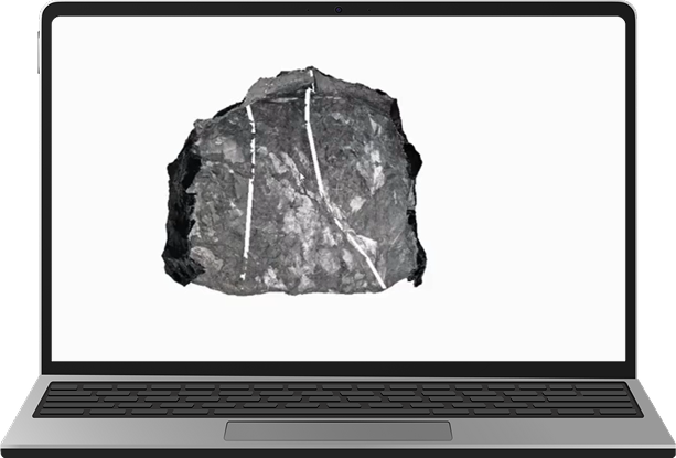
Import clean, structured datasets into Leapfrog Geo to accelerate geological interpretation, support resource estimation, and eliminate manual prep work.

data-service-focus

RockMass

Eon

footer-cta-card-1

GroundedAI

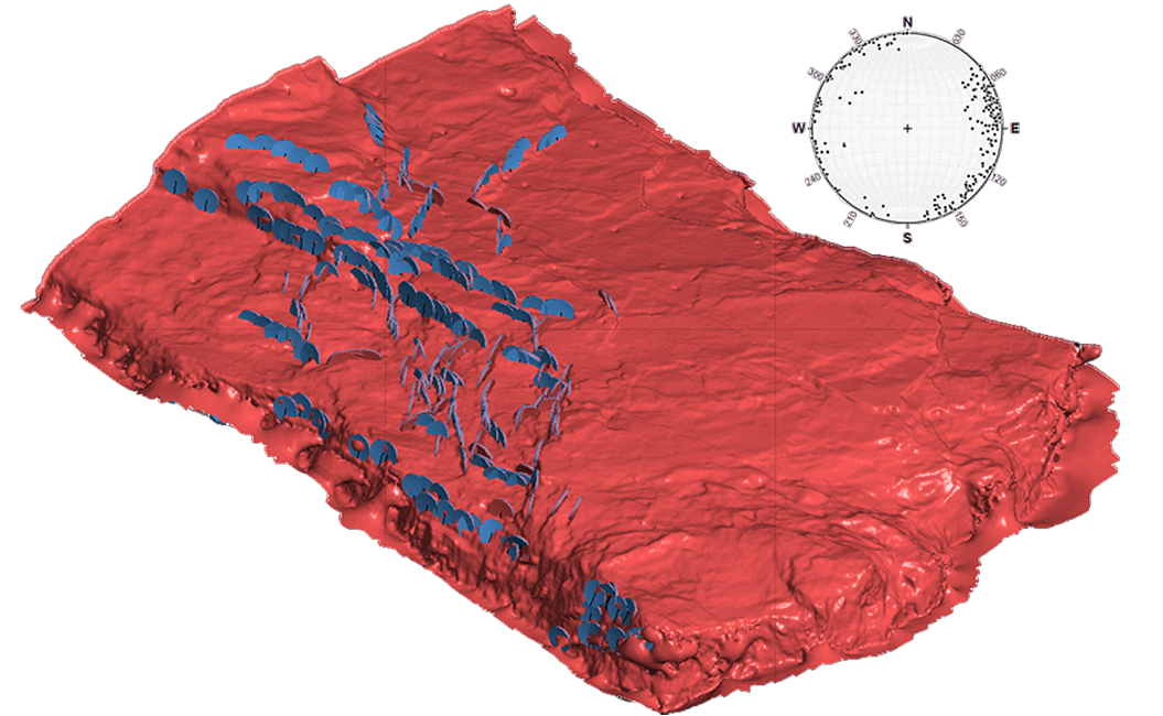
Make the underground visible

Newsletter

Stay ahead with our monthly bulletin—get case studies, product updates, and event news.

Thank you! Your submission has been received!
Oops! Something went wrong while submitting the form.
footer-cta-card-3