Ground support is essential to ensuring the safety and longevity of underground excavations. Whether managing blocky ground, high-stress conditions, or large spans, effective support design depends on accurate characterization of rock mass behavior.
RockMass Eon is helping engineers close the gap between field observations and design assumptions by delivering detailed, high-resolution structural information from the face to the engineering office, faster and more consistently than traditional methods.
Underground ground support designs are often based on incomplete or outdated structural data. Manual mapping is slow, spatially limited, and subject to variability between mappers. This can result in support decisions that are either overly conservative, driving up costs or not tailored to site-specific failure mechanisms, increasing risk.
Without current and comprehensive structural data, engineers may find it difficult to:
The absence of high-resolution, site-specific data limits the ability to design effective, cost-efficient support strategies.
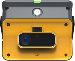
RockMass Eon combines mobile LiDAR scanning with automated structural mapping to deliver detailed discontinuity data in minutes. Deployed directly in active headings, the device captures the true-scale geometry of exposed rock faces and instantly extracts critical parameters such as discontinuity orientation, persistence, and spacing.
This structural dataset integrates seamlessly with ground support design frameworks, enabling site-specific optimization based on actual failure modes and ground behavior.

Make the underground visible

Stay ahead with our monthly bulletin—get case studies, product updates, and event news.
