So, you’ve captured the data. But now, can you prove the conditions?
That’s the ultimate question in tunnelling. Whether you’re backing up a claim, walking into a QA/QC review, or handing reports to a client, your mapping data needs more than just pretty visuals. It needs to hold up when someone starts poking holes (with their stylus pen, amirite?)
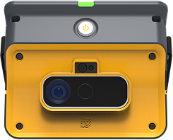
Capturing raw data is easy. Any scanner or camera can give you a pile of points or pictures. The real test is whether that data is accurate, geo-referenced, and rich enough in context to stand up to review. The reality becomes this: accuracy without traceability is just a nice image without a home. Traceability without accuracy is certainly not helpful. You need both.
Think of this checklist as your true North. Have an honest look through it, and see whether your current workflow can stand up to a technical review. Or, whether it would start to crack once someone demands proof.
Fieldwork is messy, and we know that. Shifts change, tunnel faces advance, and photos get buried in WhatsApp threads. But can your process withstand the scrutiny?
The test here is simple: can you pull up the right report when your general manager or legal counsel asks for it in 30 seconds flat? If the answer involves a frantic search through old email chains, your workflow may already be broken.
If you’re facing a dispute, it won’t matter how you captured or stored the data if you can’t turn it into a defensible, standardized report.
One weak link can sink your entire chain of evidence. If even one of these boxes goes unchecked, your data might be “nice to look at” but useless in a dispute. Defensible data is what separates a team that can withstand the scrutiny of claims and audits from a team that drowns in paperwork and finger-pointing.
Join the GroundedAI early access program to test some of the new features that transform raw underground data into traceable, auditable, and shareable decisions. Start shaping the reporting of tomorrow.
Make the underground visible
Stay ahead with our monthly bulletin—get case studies, product updates, and event news.


.jpg)